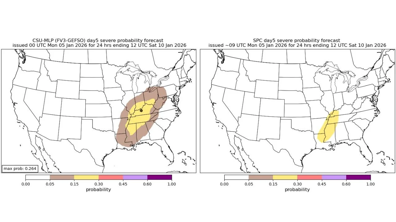
A developing storm system later this week is raising concerns for strong to potentially severe thunderstorms across parts of the Mid-South and Ohio Valley, with Kentucky, Tennessee, Arkansas, Mississippi, and southern Ohio most at risk.
Meteorologists say the approaching system is drawing warm, humid air northward as a broad upper-level trough moves in from the west. This setup increases the likelihood of damaging winds and isolated severe storms, particularly in areas where atmospheric conditions are most favorable.
Areas of Concern:
-
Western and central Kentucky
-
Middle and western Tennessee
-
Eastern Arkansas
-
Northern Mississippi
-
Southern Ohio
Forecasts show a concentrated corridor of elevated severe weather potential, where moisture, lift, and wind energy may combine to support organized thunderstorms. While the signal is focused rather than widespread, its persistence across multiple forecast frames suggests some impactful weather is likely.
Timing Uncertainty:
Experts note that the biggest unknown is timing. A slower-moving system may limit storm intensity, while a faster-moving trough could trigger stronger storms. Small shifts in the system’s speed or alignment could significantly alter where the strongest storms occur.
What Residents Should Watch For:
-
Strong wind gusts
-
Fast-moving thunderstorms
-
Localized severe weather incidents
Forecast confidence is expected to improve as the week progresses, and official watches or outlook upgrades could be issued ahead of Friday. Communities in the Mid-South and Ohio Valley are advised to stay alert and monitor updates closely.