Severe weather is expected to move through Kentucky on Wednesday, with forecasters warning of two separate rounds of storms that could bring strong winds, hail and a possible tornado threat.
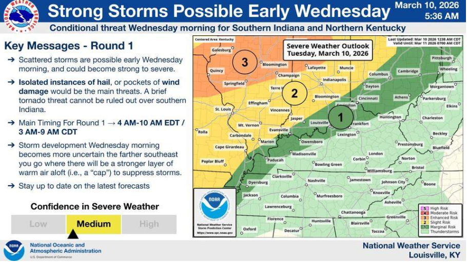
According to the National Weather Service, the first wave of storms is expected between 4 a.m. and 10 a.m. This round is forecast to be weaker, with only the northwestern parts of Kentucky — near the borders with Illinois and Indiana — placed under a marginal risk for severe weather.
Forecasters say the main threats during the morning storms include isolated hail and gusty winds. The risk of severe weather decreases toward southeastern Kentucky due to a layer of warm air that could weaken the storms.
A second and potentially stronger round of storms is expected between 2 p.m. and 8 p.m. Nearly all of Kentucky has been placed under a slight risk for severe weather during this period, meaning thunderstorms of varying intensity are possible.
The main threats during the afternoon storms include damaging wind gusts and the possibility of brief tornadoes, especially in northeastern parts of the state.
Meteorologists say the severity of the second round will depend partly on how the morning storms develop. If the early storms are widespread and persistent, they could reduce the intensity of the afternoon storms. However, if the first wave is limited, the later storms could become stronger.
Most of the state faces a 2% to 4% chance of tornado activity and a 15% to 29% chance of severe wind during the afternoon storms.
Rain showers could linger into early Thursday before a cold front moves in, bringing cooler temperatures. Forecasts for Lexington show highs around 49°F on Thursday, with temperatures expected to warm into the 60s by Friday and the 70s by Sunday.
However, forecasters warn temperatures could drop sharply early next week, with a chance of wintry showers as colder air moves into the region.