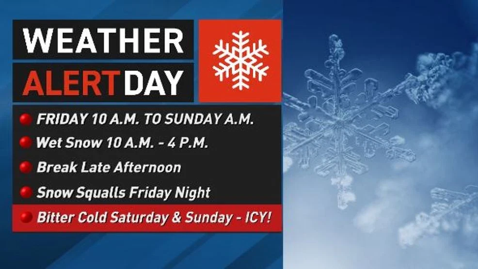
After a quiet Thursday, winter conditions will make a comeback Friday into the weekend, creating slippery roads and frigid weather.
Some afternoon sun on Thursday turned snow and ice into slush in some areas, but that will refreeze after sunset. Aside from the refreeze, tonight should be relatively calm with thickening clouds and a chance of a passing flurry in Ohio.
Friday morning commutes should be manageable locally, but snow will move south from Columbus ahead of a warm front. It is expected to reach Route 50 by 9 a.m. and spread to Interstate 64 and the Coalfields by 10–11 a.m.
With temperatures near or just above freezing, the snow will be wet and likely accumulate more on grass than roads. Still, the cold ground and steady snowfall at times could make some roads slushy by lunchtime and into the mid-afternoon.
The snow will move south by late afternoon, and main roads should become wet again for the evening commute. But the cold weather isn’t over. After sundown, an arctic cold front will arrive, likely bringing a burst of snow followed by snow showers in bands and gusty northwest winds. Winds could reach 20–30 mph in the valleys and over 40 mph in higher elevations overnight as temperatures drop sharply.
Temperatures will be in the 30s at sundown but fall to around 10 degrees in Charleston and Huntington by Saturday morning, with single digits further north. Strong gusts will push wind chills well below zero, and any remaining slush will freeze, making travel treacherous. A Cold Weather Advisory is in effect for the northern and eastern viewing areas, with Extreme Cold Warnings for the highest elevations.
Snow totals will be highest in the mountains, where a Winter Storm Warning is in effect. Four to eight inches are expected from Friday into Saturday morning, with up to 12 inches at Snowshoe and Canaan Valley.
In the valleys, 1–3 inches are expected, with roughly half falling Friday midday and the remainder likely Friday night.
While sunshine returns Saturday afternoon, temperatures will remain in the teens. Winds will calm Saturday night, but with clear skies, air temperatures could drop to near or below zero by Sunday morning.