A calm and cool start greeted South Florida early Monday, with temperatures mostly in the low 60s along the coast and upper 50s inland.
Some areas inland saw patchy dense fog, reducing visibility in certain neighborhoods.
The National Weather Service issued a Dense Fog Advisory until 9 a.m. for inland Broward County, warning that visibility could drop to a quarter mile or less.
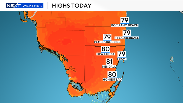
By this afternoon, highs will rise into the upper 70s with plenty of sunshine and mainly dry conditions.
Only a few isolated showers are possible.
It’s an excellent day to head to the beach, as the rip current risk remains low.
There are no alerts or advisories for boaters across the Atlantic or Keys waters.
Conditions will stay pleasant Tuesday morning, with lows in the low to mid-60s and the chance for patchy dense fog once again in some spots.
Afternoon highs will reach the upper 70s under mostly sunny skies.
Rain chances remain low throughout the week as high pressure brings a quiet and stable weather pattern.
A slight warm-up will push highs close to 80 degrees by mid to late week.
By Friday and into the weekend, morning lows will turn milder, settling in the upper 60s to low 70s.
A few showers may develop on Saturday and Sunday.